



Public safety & DFR
The drone picture, shared with the whole operation
A drone unit is only as useful as the number of people who can see what it sees. AutrikOS brings live video, telemetry and a common map to incident command in a browser, and keeps a record of every flight.
Live coordination
Everyone looks at the same picture
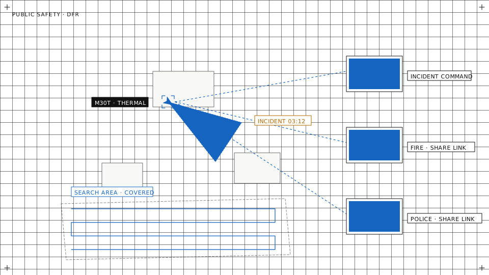
Today the picture often stays on the pilot's controller, and coordinates are read out over the radio. With a shared view, command and the teams on the ground can act on a finding at once.
About live streaming→- Live video in a browserShare the stream by link. Incident command opens it in a browser without installing software or creating an account.
- Telemetry next to the videoPosition, altitude and aircraft state are shown with the video, so viewers know where it is looking.
- Marks on a shared mapMark points, lines and areas with your own names and colours. Everyone in the workspace sees them on the map.
Live coordination
Live video · every feed on one wall, shared by link
Search
Plan the search and show what was covered
After a deployment someone asks which sectors were searched. The answer should come from the flight records, not from memory.
About the mission planner→- Draw the area, get the patternOutline the search area on the map, or load it from a KML or GeoJSON file. The planner generates the grid flight over it.
- Simulate before you flyRun the mission in simulation first to check the route before the aircraft takes off.
- Flight paths on recordThe flown path is drawn on the map during the flight and stored with the flight afterwards, with its telemetry, logs and media.
Area search
Payloads
Thermal, light and speaker from the command post
The platform controls the payloads your aircraft already has. What a camera can see at night or through cover depends on the aircraft and its sensor, not on us.
About payload control→- Thermal camera controlsSwitch between the visual and thermal camera, change the palette and read spot temperatures, on aircraft that carry a thermal payload.
- Spotlight and speakerSwitch on a searchlight or play a spoken announcement from the browser, where the aircraft has these payloads.
- On-board detections on the streamWhere the aircraft provides on-board recognition, its detections are drawn on the live video. The operator still decides what they mean.
Payload control
Simulation · thermal hand-off from a car to a fire truck, CARLA, detections boxed
Growing the unit
From one aircraft to a first-responder programme
Most units start with one aircraft and a pilot on scene. The same software carries on when you add aircraft, a dock, or a staffed operations room.
- Several aircraft, one mapAll aircraft on an operation appear on the same map and in one video grid, each with its own telemetry.
- Dispatch from a dockWith a docked aircraft, an operator sends it to a point on the map from the control room. An alarm can start the same flight.About alarm response→
- In the field todayOur stack is deployed with a major telecom operator for police drone-as-first-responder and forest-fire prevention, on DJI docks and drones over 4G.
Growing the unit
On the phone
See and launch from wherever you are
The people who decide are rarely at the console. They should not need one to see what the drone sees.
- The picture in any browser, todayA share link opens the live video on any phone or laptop, with no account and no install. You can revoke it when the operation ends.
- Into your dispatch systemVideo goes out over RTSP, RTMP or SRT, and status and events over an API and webhooks, so the aircraft can appear in the system your control room already runs.About feed sharing→
- A DFR app for the phone, in developmentFor duty officers on the move: the map, live video and status of every aircraft, and a docked aircraft sent to an address. It passes the same geofence and pre-flight checks as the control room, and there are no sticks on the phone.
Starting or growing a drone unit?
Tell us which aircraft you fly and who needs to see the picture. We will show you how a deployment runs on AutrikOS.